Land Development Design and Drafting

Transforming land into thriving developments with expert civil engineering designers and precise drafting

At Gsource, we offer comprehensive Land Development Design and Drafting services, providing everything you need for accurate and efficient land planning. Our services cover site analysis report study, engineering design, conceptual layouts, permit approvals, roadway designs & construction documentation. We ensure every detail is accounted for, helping you manage the complexities of land development with ease.

As a trusted partner for home builders, civil engineers, counties, city planners & more, we deliver customized site plans, grading, drainage, utility design & construction documentation. With our expertise in CAD, engineering & drafting, Gsource is your go-to solution for streamlined and accurate land development drafting services. Let us bring your land development projects to life with precision and professionalism.
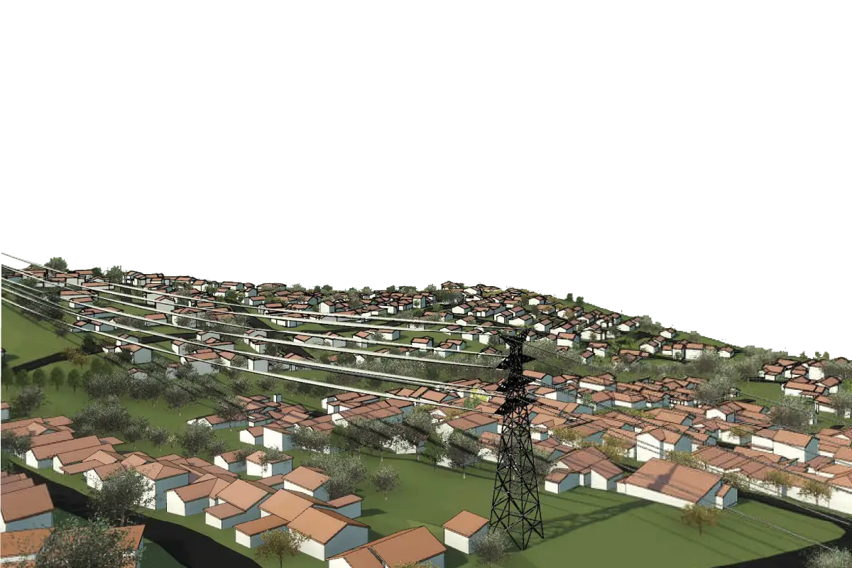
Write to Us
Land Development Design and Drafting

Land Development Design and Drafting Services

Land Development Design and Drafting Services

Site and Civil Engineering Designs

Permits and Approvals

Power & Gas Utilities

Water Utilities

General Utility Infrastructure

Why Outsource Land Development Design and Drafting Services?

Land Development designing requires detailed and specific plans and designs for your concrete structures and parts. By outsourcing this service, one can get the following benefits

Saves you your time and money through your Boundary & Topo Drafting Services

Saves you time and money according to your needs and requirements

Access a dedicated team of professionals at Gsource Technologies for expert project execution.

Access to advanced tools and software

Maintain compliance with regulatory standards through Gsource Technologies’ expert design services

Expert assistance and knowledge of designs & drafts

We at Gsource, help you with detailed and descriptive plans, designs & drafts as you require. This includes timely delivery, advanced technology, complete assistance post-completion & more. We have a team of experts who help you get your required outputs.

Our Expertise in different Domains

Highways

Signal flows, safety features, route alignment, drainage systems & more

Mass Transit

BRT, LRT, metro systems, route analysis, designing transit stations & more

Canals

Hydraulic Design, Structural Design, water management, ecological considerations & more

Streets

Street Design, pedestrian, bicycle infrastructure design, utility coordination & more

Rail systems

Track, station, terminal designs, signal and communication systems & others

Airports

Runway, taxiway, terminal designs, air traffic control systems, ground support infrastructure & other necessities

Ports

Dock & Berth Design, navigation, dredging, cargo handling systems & more

How it works

Your Project is Ready in 5 Easy Steps

01

LiDAR Data Processing and Mapping services Step1-Initial Consultation

Step 1

Initial Consultation

Firstly, we collect all your required information and needs for design and drafts required. This also includes collecting basic files and documents about your land that needs to be developed.

Initial Consultation

Firstly, we collect all your required information and needs for design and drafts required. This also includes collecting basic files and documents about your land that needs to be developed.

02

Land Development Design and Drafting Step4-Site Assessment Study

Step 2

Site Assessment Study

In this phase we ensure your project viability through detailed land surveys, regulatory reviews & soil/environmental analyses & identifying key opportunities & constraints before proceeding with design.

Site Assessment Study

In this phase we ensure your project viability through detailed land surveys, regulatory reviews & soil/environmental analyses & identifying key opportunities & constraints before proceeding with design.

03

Land Development Design and Drafting Step5-Conceptual Designing

Step 3

Conceptual Designing

Now, we develop preliminary layouts to ensure efficient land use. This includes zones, utilities, public spaces & other required spaces. These results are clear design concepts ready for detailed planning and engineering.

Conceptual Designing

Now, we develop preliminary layouts to ensure efficient land use. This includes zones, utilities, public spaces & other required spaces. These results are clear design concepts ready for detailed planning and engineering.

04

Land Development Design and Drafting Step5-Detailed Design & Engineering

Step 4

Detailed Design & Engineering

After we have our conceptual designs approved, we develop detailed technical plans. This includes plans for grading, utilities, earthworks, road network layouts, stormwater management systems & others.

Detailed Design & Engineering

After we have our conceptual designs approved, we develop detailed technical plans. This includes plans for grading, utilities, earthworks, road network layouts, stormwater management systems & others.

05

Land Development Design and Drafting Step5-Final Delivery

Step 5

Final Delivery

Finally, we have full detailed plans ready to submit. These plans are made that are feasible, safe, sustainable & according to needs and requirements of our clients.

Final Delivery

Finally, we have full detailed plans ready to submit. These plans are made that are feasible, safe, sustainable & according to needs and requirements of our clients.

Case Studies

View More Case Studies

Managing Flow - Creating Efficient Drainage Systems for Land Subdivisions

Overview -

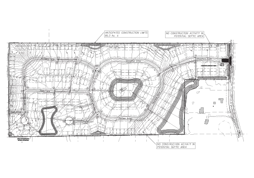
A basic drainage system plan was to be designed for the client on the given subdivision of the land. The information from the client included the land surface type that helped us understand the topography of the surface. It also had the layout of the given subdivision, including the rights of way like the pathways for pedestrians, crossways, and more, and the planned ponds in the subdivision of the land. This information was used in the planning of the drainage system in the subdivision.

Challenges -

One challenge during this land development project was a clear understanding of the client’s needs and requirements. Also, due to the challenging landscape of the subdivision, time was the major constraint. Another challenge that was encountered was insufficient storage of the ponds provided by the client for planning the drainage system. These challenges were then encountered by our top civil engineers to find a solution.

Solution -

Due to time constraints, the team needed a plan that could be followed easily. As the client provided us with excerpts of landscape drawings, land sketches, and a survey of the land, we had a basic understanding of what needed to be done. With the help of these and Civil 3D software, the following plan was created -

  1. Firstly, a Lot Grading plan was created for the provided subdivision, along with the onsite sewer treatment plan and a disposal system plan for the drainage to work properly.
  2. Then, site and development plans were made including the site plan drawing which was based on the zoning regulations. Along with this paving, grading, drainage, and utility layout plans were also prepared.
  3. After this, a stormwater pollution prevention plan was made to help control and treat the stormwater. Along with this a landscape plan was made, that meets the minimum development standards of the subdivision.
  4. A detention plan was proposed for the subdivision’s requirements on the site.
  5. After this was done, site sections were made giving the details of potable water. Also, considering the minimum lot sizes and right-of-way requirements, sanitary sewer plans for the subdivision were made.
  6. Then a master paving grading and drainage plan was made that included the sizing utilities for potable water and sanitary sewers. After this, a master utility plan was curated.
  7. After this, the drawings that included roadway profiles, stormwater pollution prevention, sanitary sewer, potable water utilities, sanitary sewer pipe design, and sized storm pipes, were to be finalized.

Finally, after all these plans and drawings were prepared, the completed plans, layouts, and drawings were delivered to the client in DWG and PDF formats.

Results -

The final submission of the files, design, plans, and layout sketches prepared using Civil 3D was approved by the client. These plans, layouts, and designs were then given to the client and they were then further used by them for the land development.

Developing Communities through Land Divisions - Charting Progress

Overview -

The division of the land provided by the client was required, to reshape the land for a new neighborhood. This process had to include dividing the land for building houses, streets, and sidewalks and putting in water and electricity utilities. All the rules and regulations were to be followed for the correct land slopes for water drainage. Thus the new pipe channels were curated for the proper sewer and drainage system.

Challenges -

The main challenge was to create the gravity and pressure network in the subdivision for the existing and new pipe network because there was no information about the same. Another difficulty that came to hand was coordinating the grading of lots with the water, sewer, and drainage pipes’ underground utilities. Enough space was to be kept between the graded surface and the utilities for the smooth working of the system and to make them accessible for maintenance.

Solution -
  1. Due to the unavailability of the current pipe network data, real-time data was collected from the client’s end on-site through a survey.
  2. Then, the current data was connected with the proposed pipe network plan, to make a new one to meet the client’s requirements.
  3. Close work was required with the utility providers to plan the layout of underground utilities using specific utility design tools.
  4. After this was done, proper grading activities were conducted to ensure adequate clearance requirements for maintenance accessibility.
  5. Finally, the files were submitted to the client in DWG and PDF formats. 
Results -

The work was appreciated from the clients’ end and they used the plan for the further development of the land and subdivision ensuring the revisit of the client to our services.

Why choose Us?

Why choose Gsource technologies-Renowned Standing

Renowned Standing

Due to skills we hold, both large and small roll-out firms want to benefit from our knowledge and expertise.

Renowned Standing

Due to skills we hold, both large and small roll-out firms want to benefit from our knowledge and expertise.

Why choose Gsource technologies-Modern Tech Solutions

Modern Tech Solutions OR Next-Gen Tech Solutions

We use high-tech solutions to understand design and construction requirements for Land Development Design and Drafting Services.

Modern Tech Solutions OR Next-Gen Tech Solutions

We use high-tech solutions to understand design and construction requirements for Land Development Design and Drafting Services.

Why choose Gsource technologies-Quick Turnaround Time

Proficient R&D Team OR Efficient R&D Team

We have an R&D team that can handle vast data collection, which can feel like a task for other companies.

Proficient R&D Team OR Efficient R&D Team

We have an R&D team that can handle vast data collection, which can feel like a task for other companies.

Why choose Gsource technologies-High Competent Staff

Quick Turnaround Time

Timely actions and efficient outputs minimize delays, maximize productivity & ensure prompt land development design and drafting services for our clients.

Quick Turnaround Time

Timely actions and efficient outputs minimize delays, maximize productivity & ensure prompt land development design and drafting services for our clients.

Why choose Gsource technologies-Close to the Mark Output

Close to the Mark Output

The data used by us for creating topographic maps, volume calculation & distance measurements provides results to the point.

Close to the Mark Output

The data used by us for creating topographic maps, volume calculation & distance measurements provides results to the point.

Why choose Gsource technologies-High Competent Staff

High Competent Staff

The experience that our team holds is what sets us apart. With training programs, our team of 300 members can deliver top-tier results laid over a 30,000-square-foot Class A Office space.

High Competent Staff

The experience that our team holds is what sets us apart. With training programs, our team of 300 members can deliver top-tier results laid over a 30,000-square-foot Class A Office space.

Why choose Gsource technologies-Affiliation with Reputable Entities

Affiliation with Reputable Entities

We are active members of national and international surveying, architectural, engineering & geospatial organizations.

Affiliation with Reputable Entities

We are active members of national and international surveying, architectural, engineering & geospatial organizations.

Why choose Gsource technologies-Advancing the field of Mortgage Survey Drafting services

Advancing the field of Land Development Design and Drafting Services

As a service provider, we’ve supported and served companies across the US. Our dedication produces excellent quality that propels industry success.

Advancing the field of Land Development Design and Drafting Services

As a service provider, we’ve supported and served companies across the US. Our dedication produces excellent quality that propels industry success.

FAQ’s

Our land development design services benefit property developers by providing comprehensive planning, ensuring efficient land use & facilitating smooth project execution.

Yes, we provide Land Development Design and Drafting services for residential, commercial & industrial projects.

Contact us to receive a custom land development design plan tailored to your property's specific requirements and zoning regulations.

Our land development design and drafting services include site analysis, conceptual design, infrastructure planning & detailed construction drawings.

Yes, we offer land development design services specifically for residential communities, including layout planning, utilities & road networks.

(Enter captcha image text in box)

Talk to us

At Gsource Technologies, we’re ready to help! Tell us what you need, and we’ll connect you with the right experts.

    captcha
    To top

    USA (Corporate ADDRESS)

    450 N Park Rd, Suite 300A,
    Hollywood, FL 33021

    UAE

    Al Safi-1, office #204-345, 12th Street,
    Al Murar-117, Dubai, UAE

    Pune

    4th Floor, B Wing, Nyati Tech Park,
    Wadgaonsheri, Pune - 411014

    Mumbai

    305, Rupa Solitaire MBP
    Mahape, Navi Mumbai 400710