Blog
Get to Know Everything About Neom Meta City: Saudi Arabia’s Futuristic City Like No Other
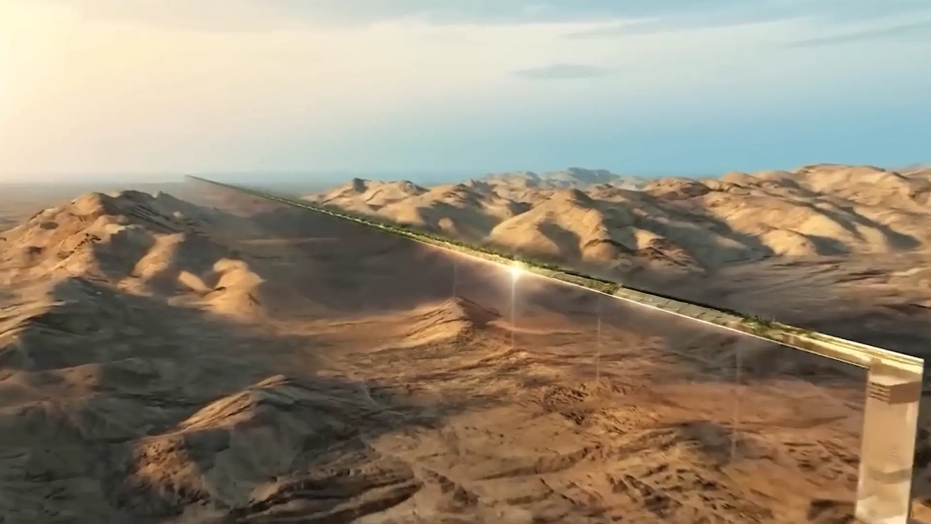
NEOM is Saudi Arabia's most ambitious urban development project—an entirely new city designed to redefine the future of urban living. Spearheaded by Crown Prince Mohammed bin Salman, this $500 billion megacity is being built as a hub of technological innovation, sustainability, and cutting-edge infrastructure.
Wed Mar 26, 2025
In-Depth Look at Gsource’s Architectural Design – From Sketch to Reality
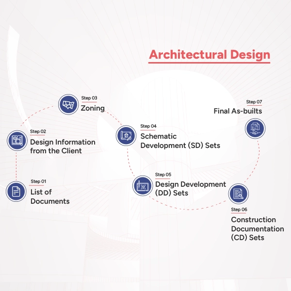
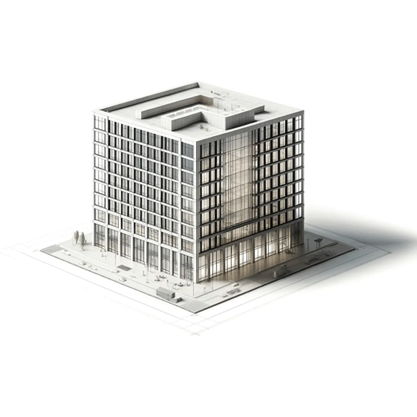
In the ever-changing field of architecture and its processes, what separates Gsource? Our creative, customer-focused approach guarantees each project is a functional and artistic masterpiece. The architectural process involves making different design sets, sketches, and documents, obtaining legal permissions, and whatnot. We create from Schematic Designs to final As-builts, and here is how we do that. Come along with us as we walk you through every stage of our architectural process, from the initial drawing to the finished building, and see how we turn concepts into real, exquisite environments.
Navigating Load Calculations for Modern Structures – Bridging Theory to Practice
Understanding the various forces at play during structural building is essential. Every element of construction needs to be carefully analyzed for safety and efficiency, from the weight of the building materials to the dynamic pressures imposed by inhabitants and climatic conditions. These computations rely on several variables. Here is a guide for you all to understand the specifics of each sort of load and how we can handle it.

Overcoming the Disparity in Construction – Design Drawings vs. Shop Drawings
In the world of construction, understanding the distinction between shop drawings and design drawings is crucial for project success. While design drawings lay the foundation for architectural vision, shop drawings translate these plans into detailed manufacturing and assembly instructions. This blog delves into the unique characteristics of each type, their roles in construction, and the process of converting design drawings into shop drawings. Let’s explore these differences to enhance clarity and efficiency in your construction projects.

A Guide to the World of Civil Engineering Drawings – The Architectural Atlas
In civil engineering, precision and foresight are key. Every project, from skyscrapers to bridges, begins with detailed drawings. These blueprints guide architects, engineers, and builders, ensuring accurate and safe construction. These drawings serve as the backbone of our built environment, ensuring that every component is constructed accurately and safely. This guide explores various civil engineering drawings, their significance, and real-world applications.

Blueprints to Buildings: A Comprehensive Guide to Architectural Drawings
Architectural drawings are vital in shaping the built environment, serving as both artistic and technical representations. These drawings facilitate communication among architects, clients, and builders, ensuring that ideas are accurately translated into physical structures. This expanded article provides an in-depth look at various types of architectural drawings, their creation process, and practical guidelines, incorporating detailed statistics to enhance understanding.

Land Surveying: A Comprehensive Guide to Definitions, Techniques, and Types
Did you know that modern land surveying can determine property boundaries with millimeter accuracy? This guide delves into the intricate world of land surveying, revealing its critical role in construction, real estate, and civil engineering. Explore the fundamentals, various techniques, and types of surveys, all enriched with authentic statistics for a thorough understanding.
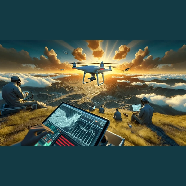
A Comprehensive Look at Drone Photogrammetry – Capturing Clarity
In the quickly developing field of aerial surveying, Drone Photogrammetry, which combines measurement science with the state-of-the-art capabilities of Unmanned Aerial Vehicles (UAVs), is a game-changer. From the fundamental ideas behind drone photogrammetry to its wide range of applications, this in-depth guide explores all the practical aspects. Whether you're a seasoned professional or a curious newcomer, this comprehensive guide will help you understand the advantages and disadvantages, explore practical applications, and master the unique terminology of drone photogrammetry.

Modern LiDAR and GPS Usage in Land Surveying
The art of land surveying has evolved dramatically over the centuries. Ancient methods, reliant on basic tools and human observation, have given way to an era of precision and technological sophistication, marked by the advent of Light Detection and Ranging (LiDAR) and Global Positioning Systems (GPS). This article explores the transformative impact of these modern technologies on land surveying, providing a comparative insight with ancient methodologies and presenting the latest statistical data to underscore their advantages and growing adoption in the field.

Revolutionizing Civil Engineering: How CAD Improves Design, Effectiveness, and Work Output
Computer-Aided Design (CAD) has revolutionized the field of civil engineering, transforming the way projects are planned, designed, and executed. This technological tool has not only enhanced the accuracy of designs but has also improved the efficiency and productivity of civil engineering projects. The application of CAD in civil engineering spans across various activities, from drafting and modeling to analysis and project management, making it an indispensable part of modern civil engineering practices.

LiDAR vs. Photogrammetry: Choosing the Right Aerial Survey Tech for Your Project
Choosing between LiDAR and photogrammetry for land surveying needs can often be a perplexing decision for many professionals across various industries. Choosing the wrong aerial survey method can result in costly delays, inaccurate data, or even project failure. With both methods offering distinct advantages and limitations, the dilemma arises in determining which technology best suits specific applications. Aerial surveying, a critical process in fields like mapping, forestry, urban planning, and environmental science, relies on capturing precise data about the earth's surface from an aerial perspective. Two primary technologies dominate this domain: Light Detection and Ranging (LiDAR) and photogrammetry. Each method possesses unique strengths and limitations, making them more suitable for certain applications over others.
(Enter captcha image text in box)