LiDAR vs. Photogrammetry: Choosing the Right Aerial Survey Tech for Your Project

Introduction
Choosing between LiDAR and photogrammetry for land surveying needs can often be a perplexing decision for many professionals across various industries. Choosing the wrong aerial survey method can result in costly delays, inaccurate data, or even project failure. With both methods offering distinct advantages and limitations, the dilemma arises in determining which technology best suits specific applications. Aerial surveying, a critical process in fields like mapping, forestry, urban planning, and environmental science, relies on capturing precise data about the earth’s surface from an aerial perspective. Two primary technologies dominate this domain: Light Detection and Ranging (LiDAR) and photogrammetry. Each method possesses unique strengths and limitations, making them more suitable for certain applications over others.
Understanding LiDAR and Photogrammetry
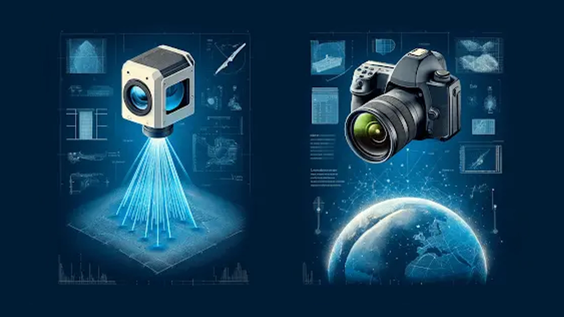
LiDAR Technology: LiDAR stands for Light Detection and Ranging. It is a remote sensing method that uses light in the form of a pulsed laser to measure variable distances to the Earth. These light pulses—combined with other data recorded by the airborne system—generate precise, three-dimensional information about the shape of the Earth and its surface characteristics.
Photogrammetry: Photogrammetry is the art and science of obtaining reliable information about physical objects and the environment through the process of recording, measuring, and interpreting photographic images and patterns of electromagnetic radiant imagery and other phenomena.
Comparative Analysis
1. The challenge lies in balancing accuracy and resolution
LiDAR: Offers high accuracy and produces high-resolution 3D models of the target area. It is particularly effective in penetrating vegetation and can map ground features with precision, offering vertical accuracy as low as 5 cm and horizontal accuracy of about 10 cm.
Photogrammetry: Typically provides a slightly lower resolution and accuracy compared to LiDAR. The accuracy depends significantly on the camera quality and the environmental conditions during the survey. Vertical accuracy is usually around 15-30 cm, while horizontal accuracy can be about 20-40 cm.
2. Issues revolving around cost-effectiveness and the availability of suitable equipment
LiDAR: Generally more expensive due to the sophisticated technology and equipment required. The initial setup for a LiDAR system can be significantly higher than for photogrammetry.
Photogrammetry: More cost-effective, especially for smaller or less detailed projects. The equipment costs are lower, and it can be conducted using conventional cameras mounted on drones or aircraft.
3. Challenges related to time optimization
LiDAR: Can quickly cover large areas, especially in regions with dense vegetation, due to its ability to penetrate canopy cover and provide accurate ground data.
Photogrammetry: Surveying time can vary depending on the project size and the detail required in the images. It can be slower than LiDAR in areas with complex topographies or dense vegetation.
4. Environmental Limitations
LiDAR: Performs well in most environments and weather conditions, although heavy rain or fog can affect the laser pulses.
Photogrammetry: Highly dependent on lighting conditions and weather. Best results are obtained under clear skies and good sunlight, which can limit its application in certain geographic areas or seasons.
5. Lack of Expertise While expertise in LiDAR or photogrammetry is rare among organizations, we have you covered with our adeptness in handling the complexities of both technologies effectively.
Applications
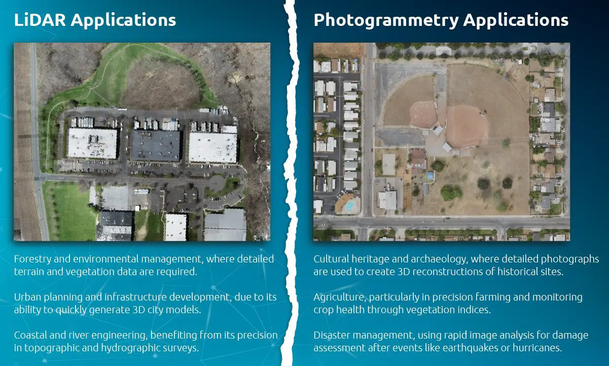
LiDAR Applications:
- Forestry and environmental management, where detailed terrain and vegetation data are required.
- Urban planning and infrastructure development, due to its ability to quickly generate 3D city models.
- Coastal and river engineering, benefiting from its precision in topographic and hydrographic surveys.
Photogrammetry Applications:
- Cultural heritage and archaeology, where detailed photographs are used to create 3D reconstructions of historical sites.
- Agriculture, particularly in precision farming and monitoring crop health through vegetation indices.
- Disaster management, using rapid image analysis for damage assessment after events like earthquakes or hurricanes.
Statistical Insights and Industry Adoption Statistics highlight the growth and adoption rates of these technologies in various industries:
- According to a market research report, the global LiDAR market is expected to grow from USD 1.1 billion in 2019 to USD 2.8 billion by 2025, at a CAGR of 15.2%.
- The photogrammetry software market is also expanding, with an expected growth from USD 3 billion in 2020 to USD 5 billion by 2026, reflecting a steady demand in sectors like film and gaming, in addition to surveying. Sources: Market research reports from reputable sources such as MarketsandMarkets, Global Research News
Choosing Between LiDAR and Photogrammetry for CAD Drafting: A Practical Guide
Choosing between LiDAR and photogrammetry for CAD drafting or other drafting perspectives depends on several factors including the specific requirements of the project, accuracy needs, and the nature of the environment being surveyed. Here’s how each technology can impact CAD drafting:
LiDAR for CAD Drafting
Advantages:
- High Accuracy and Detail: LiDAR provides highly accurate and detailed data with precise measurements, which is crucial for creating detailed and accurate CAD models. This is especially important in environments where precision is critical, such as in engineering projects or complex architectural designs.
- 3D Data: LiDAR captures rich 3D data that can directly inform the development of three-dimensional CAD models. This is particularly useful in volumetric assessments, contouring, and complex structures.
- Vegetation Penetration: LiDAR can penetrate dense vegetation, providing accurate topographical data beneath tree canopies and other obstructions. This is beneficial in planning and drafting for areas with significant natural coverage.
Disadvantages:
- Cost: LiDAR systems tend to be more expensive due to the sophisticated technology involved. This might not be cost-effective for smaller or less complex projects.
Photogrammetry for CAD Drafting
Advantages:
- Cost-Effectiveness: Photogrammetry is generally less expensive than LiDAR. This technology uses standard photographic equipment which can be mounted on drones or manned aircraft, making it accessible for smaller projects or firms with limited budgets.
- Ease of Use and Accessibility: Photogrammetric methods are often easier to deploy and do not require as specialized technical knowledge as LiDAR, facilitating quicker training and implementation.
- Visual Data: Since photogrammetry is based on photography, it captures images that can be directly used for visual analysis and presentation, adding a layer of visual information that might be useful in some types of drafting.
Disadvantages:
- Lower Accuracy Under Certain Conditions: The accuracy of photogrammetry can be affected by environmental factors such as lighting and weather conditions. It also typically provides lower spatial resolution than LiDAR, which might not be sufficient for highly detailed engineering requirements.
- Requires Clear Line of Sight: Photogrammetry requires a clear line of sight to the surfaces being photographed, which can be challenging in cluttered environments or over large vertical features.
Choosing the Right Technology for CAD Drafting For CAD drafting, the decision between LiDAR and photogrammetry often comes down to:
Required Precision: If high precision and detail are paramount, LiDAR is typically the better choice.
Budget Constraints: If cost is a major factor, photogrammetry offers a more budget-friendly option.
Project Scope: Larger, more complex projects, particularly in uneven or obstructed terrain, may benefit more from the detailed, 3D, and penetrating capabilities of LiDAR.
End Use of CAD Models: If the CAD models are used for visualization purposes or in environments where aesthetic presentation is important, the visual data provided by photogrammetry could be beneficial.
For high-precision engineering, architecture, or when working in densely vegetated or complex urban landscapes, LiDAR is generally superior. However, for simpler projects, or when budget is a significant consideration, photogrammetry can be an adequate and effective tool.
Conclusion
Choosing between LiDAR and photogrammetry for aerial surveying depends largely on the project requirements, budget, and desired accuracy. While LiDAR offers unparalleled precision and rapid data collection, photogrammetry remains a cost-effective solution for many applications, benefiting from continuous improvements in camera technology and image processing software.
As technology advances and integrates, future trends may see a combination of both LiDAR and photogrammetry being used to leverage the strengths of each method, ensuring the best outcomes for aerial surveying projects.
If you’re still feeling uncertain about which technology—LiDAR or Photogrammetry—is the perfect fit for your project, don’t hesitate to reach out to Gsource. We understand the importance of selecting the right surveying method to meet your specific needs. That’s why we offer a complimentary consultation service to help you make an informed decision. With our expertise, we’ll assess your requirements and recommend the best solution to ensure accurate and reliable survey data. Contact us today and let us assist you in achieving your project goals.
Sandeep Dhage is the Associate Director of Engineering at Gsource Technologies, leading innovative surveying and data processing solutions. With expertise in Boundary and Topographic Surveys, Commercial Boundary Surveys, ALTA/NSPS Survey Drafting, and advanced techniques like Photogrammetry, LiDAR, and Drone Data, Sandeep excels at delivering comprehensive, high-quality solutions. His dedication to understanding project challenges allows him to craft practical, industry-standard, and effective solutions with precision and efficiency. In his free time, Sandeep enjoys experimenting with drone technology, capturing stunning landscapes, and diving into complex data analysis.
Read More