ALTA/NSPS Land Survey Drafting Services

Complete ALTA/NSPS survey drafting to meet strict real estate and development standards.

ALTA/NSPS Land Surveys are essential for lenders, property dealers, mortgage insurers & others, offering a comprehensive view of any land improvements. At Gsource, we specialize in delivering detailed ALTA/NSPS Land Survey Drafting that adhere to the stringent accuracy standards set by the American Land Title Association (ALTA) and the National Society of Professional Surveyors (NSPS).

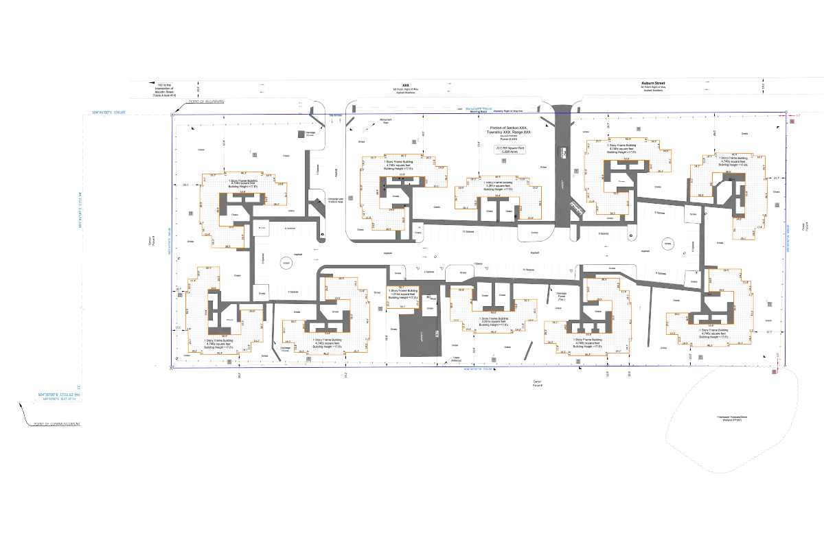
These surveys identify crucial details such as encroachments, easements, boundary lines, zoning, flood zones, right-of-ways, building locations & more, providing the clarity needed for informed decisions. Using advanced surveying technologies, we provide precise and reliable survey data to meet your specific needs.
ALTA/NSPS Land Surveying Services

What is ALTA/NSPS Land Surveying?

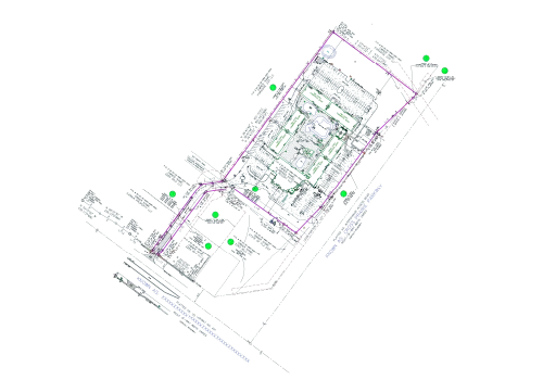
Typical Total Station Survey Points

Orthomosaic images using drones

Findings about Property Boundaries

Coverage for Title Commitment

Improvements on property

Utilities on Property

Public Access to Property

Showing Boundary Monuments

Why Outsource ALTA/NSPS Drafting Service?

ALTA/NSPS Survey Drafting can become a difficult task at times and also requires detailed and expert accompaniment. Outsourcing these services can benefit you in certain ways

Saves you your time and money

Saves you your time and money

Gives you access to experts

Gives you access to experts

Keep your designs complied with codes and regulations

Keep your designs complied with codes and regulations

Get access to advanced technologies and tools

Get access to advanced technologies and tools

Here, at Gsource, we have skilled professionals and experts who provide our clients with precise and accurate designs and drafts for their ALTA/NSPS-surveyed land. We have advanced tools for drafting including AutoCAD and more to get you apt results that also comply with codes and regulations.

Our Expertise in different Domains

Real Estate Development

Residential, commercial & industrial properties.

Construction

Infrastructure projects such as roads, bridges & buildings.

Environmental

Wetland delineation, floodplain mapping & conservation projects.

Utilities

Power lines, pipelines & water supply networks.

Government

Municipal planning, public works & transportation departments.

How it works

Your Project is Ready in 5 Easy Steps

01

Step 1

Collecting Required Information

We gather all necessary documents from clients, including base drawings, point cloud files (.txt/.csv), deed info, building sketches, FEMA maps, zoning data, adjacent property owner info, previous surveys, site photos & .ctb files for plotting.

Collecting Required Information

We gather all necessary documents from clients, including base drawings, point cloud files (.txt/.csv), deed info, building sketches, FEMA maps, zoning data, adjacent property owner info, previous surveys, site photos & .ctb files for plotting.

02

Step 2

Preparing for Linework

Now, we start with preparing linework. Here we convert survey figures to 2D polylines, create and lock new layers & draft boundary features for further linework.

Preparing for Linework

Now, we start with preparing linework. Here we convert survey figures to 2D polylines, create and lock new layers & draft boundary features for further linework.

03

Step 3

Creation of Detailed Linework

Now, we move with detailed linework by connecting surveyed points using Google Maps/Earth and site photos for drafting. A fixed sequence is followed to create linework and then utilities are placed using given sources.

Creation of Detailed Linework

Now, we move with detailed linework by connecting surveyed points using Google Maps/Earth and site photos for drafting. A fixed sequence is followed to create linework and then utilities are placed using given sources.

04

Step 4

Labeling and Adding General Text

After detailed linework, we move forward with labeling and text adding, where we label street names, POB/POC, bearing basis, boundary dimensions, adjacent property owners, building details & amp; general site labels.

Labeling and Adding General Text

After detailed linework, we move forward with labeling and text adding, where we label street names, POB/POC, bearing basis, boundary dimensions, adjacent property owners, building details & amp; general site labels.

05

Step 5

Verification & Finalization

Finally, in end, we verify every linework, label & text and submit final output to our clients. If there are any changes or modifications from client, they are made and the final file is re-submitted.

Verification & Finalization

Finally, in end, we verify every linework, label & text and submit final output to our clients. If there are any changes or modifications from client, they are made and the final file is re-submitted.

Why choose Us?

Renowned Standing

Due to skills we hold, both large and small roll-out firms want to benefit from our knowledge and expertise.

Renowned Standing

Due to skills we hold, both large and small roll-out firms want to benefit from our knowledge and expertise.

Modern Tech Solutions

We use high-tech solutions to understand design and construction requirements for ALTA/NSPS Land Survey Drafting Services.

Modern Tech Solutions

We use high-tech solutions to understand design and construction requirements for ALTA/NSPS Land Survey Drafting Services.

Proficient R&D Team

We have an R&D team that can handle vast data collection, which can feel like a task for other companies.

Proficient R&D Team

We have an R&D team that can handle vast data collection, which can feel like a task for other companies.

Quick Turnaround Time

Timely actions and efficient outputs minimize delays, maximize productivity & ensure prompt ALTA/NSPS services for our clients.

Quick Turnaround Time

Timely actions and efficient outputs minimize delays, maximize productivity & ensure prompt ALTA/NSPS services for our clients.

Close to the Mark Output

The data used by us for creating topographic maps, volume calculation & distance measurements provides results to the point.

Close to the Mark Output

The data used by us for creating topographic maps, volume calculation & distance measurements provides results to the point.

High Competent Staff

The experience that our team holds is what sets us apart. With training programs, our team of 300 members can deliver top-tier results laid over a 30,000-square-foot Class A Office space.

High Competent Staff

The experience that our team holds is what sets us apart. With training programs, our team of 300 members can deliver top-tier results laid over a 30,000-square-foot Class A Office space.

Affiliation with Reputable Entities

We are active members of national and international surveying, architectural, engineering & geospatial organizations.

Affiliation with Reputable Entities

We are active members of national and international surveying, architectural, engineering & geospatial organizations.

Advancing the field of ALTA/NSPS Land Survey Drafting services

As a service provider, we’ve supported and served companies across the US. Our dedication produces excellent quality that propels industry success.

Advancing the field of ALTA/NSPS Land Survey Drafting services

As a service provider, we’ve supported and served companies across the US. Our dedication produces excellent quality that propels industry success.

FAQ’s

We use new and innovative technologies to be accurate and precise in our Land Survey Drafting results. Also, we adhere strictly to ALTA and NSPS guidelines to provide best service. 

One can get a detailed knowledge of land they are investing in and help solve any kind of boundary or land-related issues. This also helps in identifying amount of land within their territory. 

We will require any legal description of the land present, base drawing file, point cloud file in .txt or .csv format, .ctb file, site photos, FEMA map, any prior survey done & adjacent property owner information. There are more inputs depending on land and output desired. 

The time and cost required for ALTA/NSPS survey drafting depend on output required, input given, area of land & other such factors. 

ALTA/NSPS survey draftings are valid until any new changes or modifications are made to property. But sometimes lenders require updated land surveys to avoid further issues or disputes. 

(Enter captcha image text in box)

Talk to us

At Gsource Technologies, we’re ready to help! Tell us what you need, and we’ll connect you with the right experts.

    captcha Please select your preference for receiving SMS updates and notifications regarding your inquiry:
    To top

    USA (Corporate ADDRESS)

    450 N Park Rd, Suite 300A,
    Hollywood, FL 33021

    UAE

    Al Safi-1, office #204-345, 12th Street,
    Al Murar-117, Dubai, UAE 33027

    Pune

    4th Floor, B Wing, Nyati Tech Park,
    Wadgaonsheri, Pune - 411014

    Mumbai

    305, Rupa Solitaire MBP
    Mahape, Navi Mumbai 400710